Resources
Permit and Camping Information
Multiple areas along the Great Colorado Route require day-use fees, overnight permits, or have other camping regulations. While this page is not exhaustive (and may contain inaccuracies), it summarizes many of the key considerations along the route.
Table of contents
Section 1 - Black Canyon of the Gunnsion
Section 4 - Colorado National Monument
Section 5 - Dominguez Canyon
Section 7 - Mount Sneffels Wilderness
Section 13 - Bennett Peak
Section 14 - Sangre de Cristo High Route
Section 15 - Grape Creek
Section 17 - Pikes Peak
Section 24 - Indian Peaks (this information is especially important)
Section 25 - Rawah Wilderness
Section 26 - Walden Valley
Section 28 - Sarvis Creek Wilderness
Section 30 - Maroon Bells—Snowmass Wilderness
Section 31 - Ruby Range Traverse
Section 1 - Black Canyon of the Gunnison
Black Canyon of the Gunnison National Park
Black Canyon of the Gunnison National Park’s North Rim roads and facilities are typically closed till early May. Hikers are allowed and can self-register at the ranger station before then, but the only water while facilities are closed is the Gunnison River at the base of the canyon. Descending to the canyon floor may prove especially hazardous while snow, ice, and/or slick mud are present.
The GCR enters Black Canyon of the Gunnison National Park for roughly 9 miles and requires an entrance pass (whether a $15 standard pass or America the Beautiful Pass). Camping in this park campground isn’t recommended since permits are competitive and pricey whereas you can camp for free in BLM land northwest of the park (before descending into Gunnison Gorge Wilderness along Buttermilk Ridge). Doing an optional sidequest down Pinyon Draw is highly recommended. It requires a free, first come, first served inner canyon permit that can be obtained at the ranger station nearby. The permit also allows you to camp in the inner canyon for free for up to three nights. Hikers of the inner canyon must pack out human waste in a WAG bag.
Gunnison Gorge Wilderness and National Conservation Area
The road used to connect Black Canyon of the Gunnison and Gunnison Gorge Wilderness is seasonally closed to all traffic (including hikers) from March 15 - May 15.
The GCR enters Gunnison Gorge Wilderness for roughly 10 miles and requires a $3 day use fee that can be purchased online here. Camping in the wilderness is at designated sites only and requires a separate overnight pass which is only available for cash purchase at trailheads that the GCR does not pass. (More information can be found here). Camping is available to the southeast above Buttermilk Ridge or to the north in the overflow camping area near Rabbit Gulch labeled with a brown post. Hikers must pack out human waste in a WAG bag.
Fording the North Fork
To exit the Gunnison Gorge Wilderness, the GCR follows the “North Fork to Smith Fork Trail” which requires a ford across the North Fork of the Gunnison River. If water levels are too high, you may need to arrange or improvise a ferry. Contact Gunnison River Pleasure Park for information.
Section 4 - Colorado National Monument
Rattlesnake Arches
Camping is not permitted within 1/4 mile of the Rattlesnake Arches Loop and along the access road to the trailhead. Camping should be fine between Mee Canyon Trailhead (roughly 17 miles from Fruita along the GCR) and the Black Ridge Parking area at the western boundary of Colorado National Monument (roughly 25 miles from Fruita along the GCR). More information. Please note there is likely no water along this entire stretch, first guaranteed water being the visitor center in the Monument.
Colorado National Monument
The GCR enters Colorado National Monument for roughly 30 miles minus a brief intermission of BLM land and private property near Pinyon Airport. Colorado National Monument requires an entrance pass (whether a $15 standard pass or America the Beautiful Pass) and free backcountry use permit that can be obtained at the visitor center (which you will need to visit anyway for water). Camping is legal but hikers must abide by park regulations—nothing too different from most areas (information). The only guaranteed water in the Monument is the visitor center in the northwest and the Devil’s Kitchen Picnic Area in the southeast. Hikers may want to consider improvising a ride to the visitor center both from Liberty Cap Trailhead and Ute Canyon Trailhead for water. There is also a general store and church in Glade Park not too far from the western trailhead to No Thoroughfare Canyon.
Section 5 - Dominguez Canyon
Dominguez Canyon Wilderness
The GCR crosses Zones 1, 2, and 3 of the Dominguez Canyon Wilderness. The primary considerations for GCR hikers are that camping is not allowed in Zone 1 (near the northern mouth of the canyon and Gunnison River) and that visitors must pack out human waste in Zone 2 (Big Dominguez Canyon and Little Dominguez Canyon ~ roughly 20 miles of the GCR). Review regulations and a map of the zones here.
Section 7 - Mount Sneffels Wilderness
Mount Sneffels Wilderness
The Mount Sneffels Wilderness introduced new regulations for the 2026 season that requires human waste to be packed out, overnight hikers to use IGBC approved bear-resistant food storage (to the best of our knowledge, this includes Ursaks and Adotecs), and prohibits camping at Middle and Upper Blue Lake. In 2027, they also plan to implement recreation.gov permit requirements, which we will update once that information is rolled out. More information can be found here.
There are privies located at the Blue Lakes Trailhead, and the GCR crosses the wilderness area for only 5 miles (roughly one mile from trailhead to Blue Lakes Pass). Hikers can avoid the bear-can requirements by camping outside of this stretch, though be aware that dispersed camping is hard to come by in Yankee Boy Basin since most of it is on private property with public easements that don’t allow overnight stays. More information can be found here.
Sections 13 - Bennett Peak
Towards the end of this section, the GCR crosses the San Luis Valley for roughly 29 miles to the town of Alamosa. Before Alamosa, no legal camping options exist due to private property and the prohibition of camping within Monte Vista Wildlife Refuge. Hikers with trail legs should be able to complete this roadwalk in a day and arrange lodging or camping options in / near Alamosa.
If taking the alternate that goes through Center and Hooper instead, hikers have a very long stretch with limited camping and lodging options. Save for a the one hotel in Center and one campground in Hooper, your best bet would be hiking roughly 44 miles (while also taking time to resupply and recharge devices) to the western boundary of Great Sand Dunes National Park and getting a camping permit (see below). For this reason, we think most hikers will prefer the main route, even if it’s longer.
Section 14 - Sangre de Cristo High Route
San Luis Valley
This section of the GCR crosses the San Luis Valley for roughly 21 miles from Alamosa to Lake Como Road. No legal camping options exist along this stretch, so hikers are encouraged to complete it in a day. Lodging is available in Alamosa. Camping is available along Lake Como Road after entering Rio Grande National Forest — the best options being near the lake itself.
Zapata Falls
After exiting the Sangre de Cristo Wilderness just southeast of Zapata Falls, camping is only allowed at the Zapata Falls Campground which requires a permit that can be purchased here. It is roughly 12 miles between the wilderness boundary and the start of Great Sand Dunes National Park.
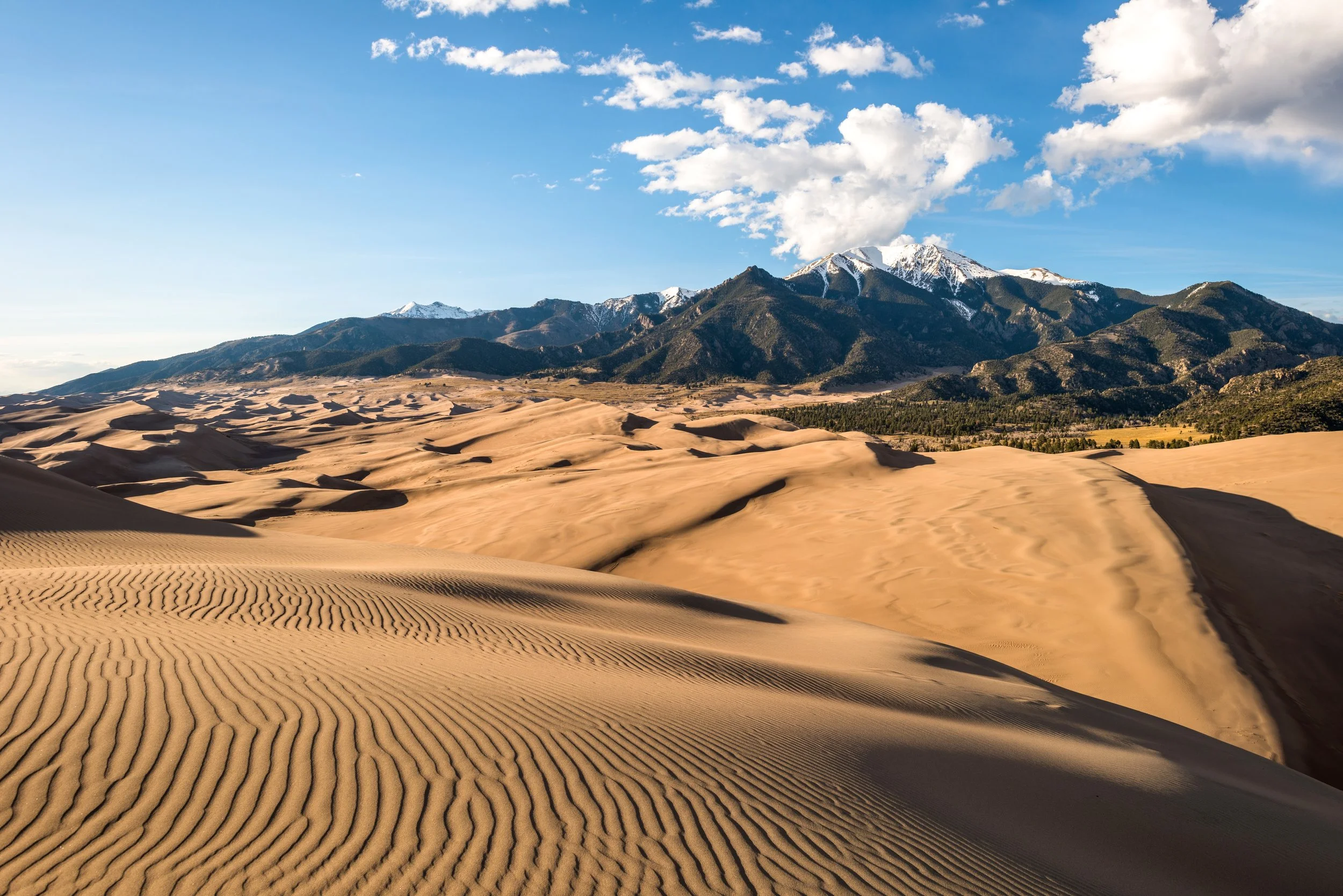
Great Sand Dunes National Park
The GCR crosses Great Sand Dunes National Park and Preserve for roughly 20 miles (from the Entrance Station to Music Pass), and the section across the sand dunes can be slow going. The park requires an entrance pass (whether a $15 standard pass or America the Beautiful Pass) and $6 per night backcountry camping permit that can be purchased here. There is no water in the dunes (unless hiking in the winter when snow can be melted), and the temperatures can be quite hot, so hikers will want to load up at the Visitor Center and carry enough to get to Sand Creek or vice versa (roughly 10 miles).
Wet Mountain Valley
The GCR crosses Wet Mountain Valley for roughly 15 miles before entering BLM land along Grape Creek. The vast majority of the valley is private property, so hikers may want to consider lodging options in Westcliffe which the GCR passes directly through.
Section 15 - Grape Creek
Upper Grape Creek
UPDATE: It was recently brought to our attention that the intended route through Upper Grape Creek WSA is inaccessible from the Westcliffe side due to private property. After chatting with the local BLM office, we have identified a legal entrance to the WSA via Dead Mule Lane at these GPS Coordinates: 38.233325, -105.406782. If for whatever reason this access point becomes inaccessible, the backup option is bypass Upper Grape Creek by taking Oak Creek Grade (County Road 255) to Access Road 6227 (near Yorkville) to reach the Bear Gulch Trailhead to enter Lower Grape Creek WSA. The GPX download does not currently reflect this update.
After Iceman’s hike, we will also investigate heavily modifying the main route by cutting the San Luis Valley and go from La Garita to Salida, south through the Sangres, across the Greenhorn Mountain Wilderness, and then up along the Wet Mountains to Lower Grape Creek. This update is too substantial to incorporate in Iceman’s hike this year.
Royal Gorge Bridge Park
We are also in talks with the Royal Gorge Bridge Park to allow hikers to cross the bridge from the rear entrance near Temple Canyon then exit through the main entrance near US Highway 50. Cyclists are currently permitted to access the park this way with valid day or season passes, so there’s some precedent for this request. Currently this route is not established, recognized, or honored, so for the time being we encourage hikers to instead follow the main route through Lower Grape Creek directly to Canon City. If crossing the bridge gets approved, it would almost certainly require a day pass or other fee. The park’s website can be found here.
Section 17 - Pikes Peak
Manitou Incline & Barr Trail
The GCR treks up the Manitou Incline which requires a timed-entry permit which is free and can be reserved here. The neighboring Barr Trail is accessible 24/7 and be taken as an easier alternate. Dispersed camping is unavailable till past the Incline. About halfway up Pikes Peak is the Barr Camp which provides hikers who book a reservation (for a fee) a fully enclosed shelter, restrooms, and breakfast. Alternatively, about three quarters up Pikes Peak is the A-Frame Shelter, a three-wall lean-to that is free and first-come, first-served.
Mueller State Park
The GCR does not enter Mueller State Park but some hikers may want to consider its campground for camping options in the area. More information can be found here. Similarly, Florissant Fossil Beds National Monument is just a little further west. Unfortunately, there is no convenient way to connect the state park and national monument by foot due to private property between them. Roadwalking or arranging a ride is possible, but it’s too far out of the way for the GCR to realistically incorporate at this time.
Section 24 - Indian Peaks
This is the logistically most challenging section of the Great Colorado Route.
Indian Peaks Wilderness
The GCR crosses Indian Peaks Wilderness for roughly 26 miles (Rollins Pass through Ogalalla Peak). IPW requires zone-based camping permits. Most of these permits are released and booked up well before thru hikers have any clue when they will be there. That said, the IPW also releases 3 Days in Advance permits that release, well… 3 mornings in advance of the reservation date (e.g., permits for Saturday night release on Thursday morning at 8:00 AM). The GCR then immediately enters Rocky Mountain National Park at Ogalalla Peak.
Rocky Mountain National Park
Section 24 of the GCR crosses Rocky Mountain National Park for roughly 40 miles (Ogalalla Peak through Estes Park, not counting the terrain north of Estes in Section 25). RMNP requires an entrance pass (whether a $15 one-day pass, $20 seven-day pass, or America the Beautiful Pass). RMNP also restricts camping to designated sites only, and wilderness permits usually book up months in advance. To further complicate matters, permits are required to be picked up in person (no more than 30 days in advance) at the Headquarters Wilderness Office near Estes Park or Kawuneeche Visitor Center near Grand Lake during business hours (7:00am-3:30pm), both of which are out out of the way. Lastly, RMNP also requires hard-sided bear cans for overnight visitors.
Possible Itineraries without RMNP camping permits.
Here are some possible itineraries (sorted from hardest to easiest) for hikers with strong legs and solid endurance navigating Rocky Mountain National Park without overnight permits. These itineraries are by no means exhaustive, and they can be mixed and matched. More routes are provided on the GCR route page. Please keep in mind that most of these options require good weather.
Main Route Itinerary (red line on this map). This is probably the least sucky way to do the GCR main route without RMNP camping permits, but it involves shuttling in and out of RMNP for one night.
Day 1 - ~19 miles from Berthoud Pass to Devil’s Thumb Pass. Camp slightly downhill near a water source along the CDT (rough coordinates: 40.04158, -105.67956). This site is technically within the Indian Peaks Wilderness “Columbine” Zone. A Columbine permit can be purchased three mornings before the night of stay (e.g., if camping here on a Wednesday night, permits can be purchased at 8:00 AM on Monday morning).
Day 2 - ~20 tough miles from Devil’s Thumb campsite to Gourd Lake along the GRC main route. This site is within the Indian Peaks Wilderness “Buchanan” Zone, a permit for which can be purchased three mornings in advance at 8:00 AM.
Day 3 - ~22 really tough miles from Gourd Lake to Glacier Gorge Trailhead. From the trailhead, arrange/bum a ride into Estes Park and get lodging for the night. (In a perfect world, hikers would have a RMNP Boulderfield campsite reservation since it is only 14 miles from Gourd Lake, but this requires incredible luck, an in-person permit pickup in town, and a bear can).
Day 4 - Get a ride from Estes Park back to Glacier Gorge Trailhead, then hike ~24 miles back to Estes along the GRC. If you stay at the same lodging as the night prior, you can slackpack this day.
RMNP in a Day Itinerary (yellow line on this map). For those wanting to avoid the shuttle in the above itinerary, they can consider a this cutoff option:
Days 1 and 2 - Same as above.
Day 3 - Start the same as above, but after descending Longs Peak, instead take the Estes Park Cutoff Alternate. This would be ~29 miles in one day, but the last ~14 are trails and then roads directly into Estes Park where you would then get lodging for the night. You will be very tired and likely hike very late into the night.
Ouzel Creek Alternate Itinerary (purple line on this map). For those wanting to experience most of the GRC main route but bypass the intimidating crux from The Cleaver to Pagoda Mountain, they may consider this option:
Days 1 and 2 - Same as above.
Day 3 - ~17 tough miles from Gourd Lake, taking the GRC main route till Isolation Peak, then taking the Ouzel Lake Bailout Alternate, and finishing in Allenspark. Allenspark has a couple dispersed camping options, lodging options, as well as Olive Ridge Campground (that will likely be booked, but reservations can be checked here).
Day 4 - Get an early start and hike ~27 miles from Allenspark, taking the Keplinger Couloir Alternate up Longs Peak, continuing along the GRC main route until Estes Shortcut Alternate, then taking that directly into Estes Park. Get lodging for the night.
This itinerary can be further simplified by instead camping at Fox Park on Night 2 (still in IPW’s Buchanan permit zone) then taking the Buchanan Pass Alternate to Allenspark on Day 3. This modified version is the blue line on the this map.
Lake Verna Alternate Itinerary (black line on this map). For those wanting to bypass both 1) the crux from The Cleaver to Pagoda Mountain and 2) Longs Peak, they can consider this option:
Day 1 and 2 - Same as above.
Day 3 - ~18 tough miles from Gourd Lake, taking the GRC main route till Lake Verna Alternate, then taking that all the way to Grand Lake. Hikers can camp at the community center for a $25 fee.
Day 4 - ~31 trailed miles from Grand Lake to Estes Park along the CDT Alternate until reconnecting with the GCR main route near Squaretop Mountain, then taking that directly into Estes. Get lodging for the night.
CDT Alternate Itinerary (green line on this map). Finally, for those wanting a low route, they can instead take the CDT to Grand Lake then rejoin the GCR at Squaretop Mountain.
Day 1 - Same as above.
Day 2 - ~30 miles from Devil’s Thumb to Grand Lake along the CDT. (There are other camping options before Grand Lake if 30 miles isn’t feasible). Camp at the Community Center for $25.
Day 3 - ~31 trailed miles from Grand Lake to Estes Park along the CDT Alternate until reconnecting with the GCR main route near Squaretop Mountain, then taking that directly into Estes. Get lodging for the night.
Section 25 - Rawah Wilderness
Rocky Mountain National Park
Section 25 of the GCR crosses Rocky Mountain National Park for roughly 20 miles from Estes Park to Pingree Park then reenters RMNP for 7 miles briefly thereafter. Hikers are encouraged to camp outside these areas to avoid any permit or bear canister headaches. For more more information about RMNP permits and requirements, see the information above for Section 24.
State Forest State Park
The GCR weaves in and out of State Forest State Park for roughly 18 miles from Jack Dickens Trail intersection to the eastern edge of Walden Valley. The state park requires daily fee of $4 which can purchased through the My CPW mobile app. Cell service is typically available on the ridgeline just before entering the park, allowing for on-the-spot purchases if needed. Alternatively, permits can be obtained at the lower park entrances. More information can be found here.
Section 26 - Walden Valley
The GCR crosses Walden Valley for 33 miles along roads that abut a patchwork of BLM land and private property, including the town of Walden. Lodging and resupply options are available here. Though GCR does not go through it, directly south of Walden is the Arapaho National Wildlife Refuge which prohibits overnight camping.
Section 28 - Sarvis Creek Wilderness
Yampa Valley
The GCR crosses Yampa Valley for 22 miles along roads that abut private property, including the town of Yampa. Lodging and resupply options are available in town.
Stagecoach State Park
Hikers taking the Oak Creek Alternate pass through Stagecoach State Park which requires a day-use fee. More information can be found here. This alternate also passes through a couple small sections of State Wildlife Areas (SWAs) that prohibit overnight camping.
Section 30 - Maroon Bells—Snowmass Wilderness
Rio Grande Trail
The GCR crosses the urban Rio Grande Trail for roughly 17 miles from Glenwood Springs to just past Carbondale. No camping is allowed along this trail, nor would it be desirable. Hikers should be able to make it back to public lands within a day, whether the BLM land directly after the Rio Grande Trail or White River National Forest (roughly 27 cruisy miles from Glenwood Springs). Lodging is also available in towns.
Maroon Bells—Snowmass Wilderness
The GCR crosses Maroon Bells—Snowmass Wilderness (MBSW) for roughly 17 miles from Capitol Creek Trailhead to Geneva Lake Trailhead, then reenters the wilderness for roughly 22 miles from Geneva Lake Trailhead to Schofield Park. The MBSW requires overnight visitors to use an IGBC-approved bear-resistant food container (Ursack and Adotec bags are allowed). The MBSW is also divided into Permit Zones with different camping and reservation requirements. Click here for a map of the different zones. Some areas only require self-registering for free at the trailhead. Other zones require advance permits that are competitive, often book up, and can be checked here.
Hikers can bypass MBSW’s camping and food-storage regulations by simply camping outside the wilderness area’s boundaries (e.g., north of Capitol Creek Trailhead, near Geneva Lake Trailhead, and at or south of Schofield Park). Alternatively, the section after Capitol Lake till Geneva Lake Trailhead does not require an advance permit (just self-register at Capitol Creek Trailhead—food-storage requirements still apply).
The GCR encourages hikers to take the sidequest to Maroon Lake to view “Colorado’s most photographed spot.” This trailhead also provides town access to Aspen via the Maroon Bells Shuttle (advance permit is recommended). Most hikers will probably prefer the logistically simpler option of waiting until Crested Butte to resupply.
Section 31 - Ruby Range Traverse
Due to public access disputes across private property downhill from Green Lake, we recommend exiting the traverse via Scarp Ridge Trail, which is currently not reflected on the GPX download. Please be respectful of private property.